If you search for 'Scholmwehrbrücke' in the internet, you get besides the GPS coordinates
Latitude 51°37'43.6 "N (51.628791°)
Longitude 10°28'15.3 "E (10.4709223°)
including the following information:
Street name: Scholmwehrbrücke
Street type: Footpath
Place: Bad Lauterberg in the Harz Mountains
zip code: 37431
State: Lower Saxony
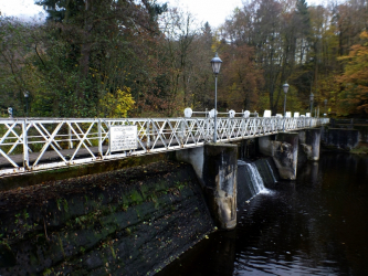
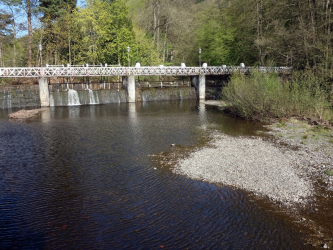
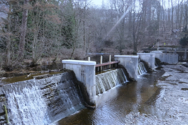
But being only a footpath to connect the ‘Kirchberg’ and the spa center of Bad Lauterberg is not the primary task of this structure. Initially called 'Oderwehr', the weir named 'Scholm- or Scholbenwehr' is first and foremost a hydraulic structure and serves to dam up the water of the Oder, channel it to the ‘Königshütte’ for making it usable there.
Today, the weir named 'Scholmwehr' is located in the area of the spa park. It was built there in 1733. The water of the river Oder is led from the weir through an approximately 1.4 km long hut ditch with a gradient of two meters to the kings hut (‘Königshütte’) and in 1803 it drove 23 water wheels on three gradients at the kings hut (Königshütte). On the first gradient - in the area of the casting hall, where the blast furnace hall once stood - seven waterwheels were driven, on the second gradient - in the area of today's mill - there were ten, and on the third gradient - it was in the area of the former wire hut, now the Bad Lauterberg building yard - six waterwheels were driven. The waterwheels (all top-bladed) in turn served to drive the bellows, the punching and hammering mills, the rolling mills and, at the wire hut (Drahthütte), the bellows in the fresh and zain huts.
Incidentally, one of the waterwheels drove an endless rope for the machine factory. The water wheel was located in a water channel that was located between the two building sections of the rolling mill. You can still see today where the rope led into the machine factory. Under the site, the water from this former ditch now runs underground.
If the Oder itself did not carry enough water, water from the Wiesenbek pond could be used since 1738. Since 1738 - the year in which the copper mine named ‘Aufrichtigkeit’ was closed down - until the year 1980, the kings hut (Königshütte) owned a right to use the water from the Wiesenbek pond. The wire smelter, which was located on the third slope, was sold to the town of Bad Lauterberg in 1920.
Two turbines - one on each slope - produce electricity for their own use and to maintain the Königshütte. Installed in 1938 or 1949, they still do their job today and run flawlessly except for a few intermittent 'jerks'. The older turbine system with centrifugal governor even dates back to 1916.
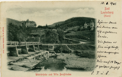
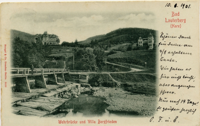
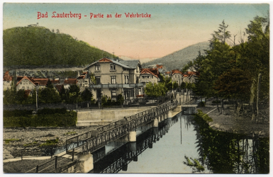
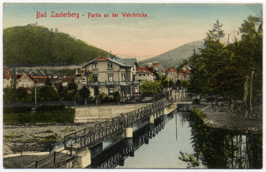
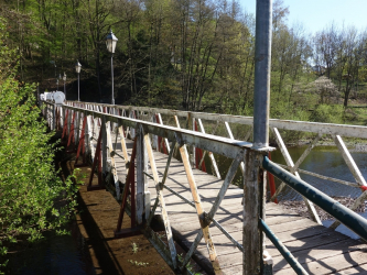
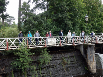
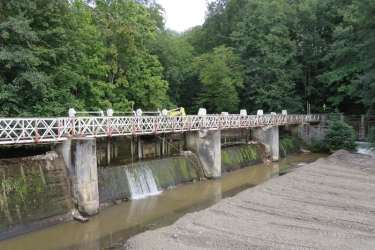
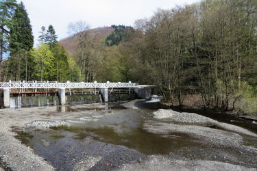
The Scholmwehr Bridge, which was initially called the Oderwehr Bridge machine factory, has been destroyed twice by floods. After the destruction by a flood in 1833 it was rebuilt in wooden construction according to the old plans, after the second flood on September 2, 1904 the now private owners of the kings hut (Königshütte) decided to rebuild the weir bridge in concrete and steel construction. It was completed in 1905. The main feature was the widening of the water flow to 12 meters. The bridge of the Scholmweir still offers this view today, of course after several restorations.
The last major restoration is now almost completed and soon the weir bridge will shine again in new splendor.
In 1923, a recess was negotiated for the weir bridge between the town of Bad Lauterberg and Königshütte Rudolf Holle, who was the owner that time, named 'factory owner in Königshütte near Bad Lauterberg'. (for information: recess means a (written) result of a negotiation). It says the bridge was 'opened for pedestrians and as a bridge for handcarts to connect the streets ... for everyone'. In return, the municipality of Bad Lauterberg made a commitment to 'maintain the wooden decking on the bridge deck'. This right of use for the town of Bad Lauterberg is unlimited.
Today, the owner of the Scholmwehr bridge is the 'Königshütte Industriedenkmal UG', but the weir bridge is located on municipal land, the riverbed of the Oder.

